
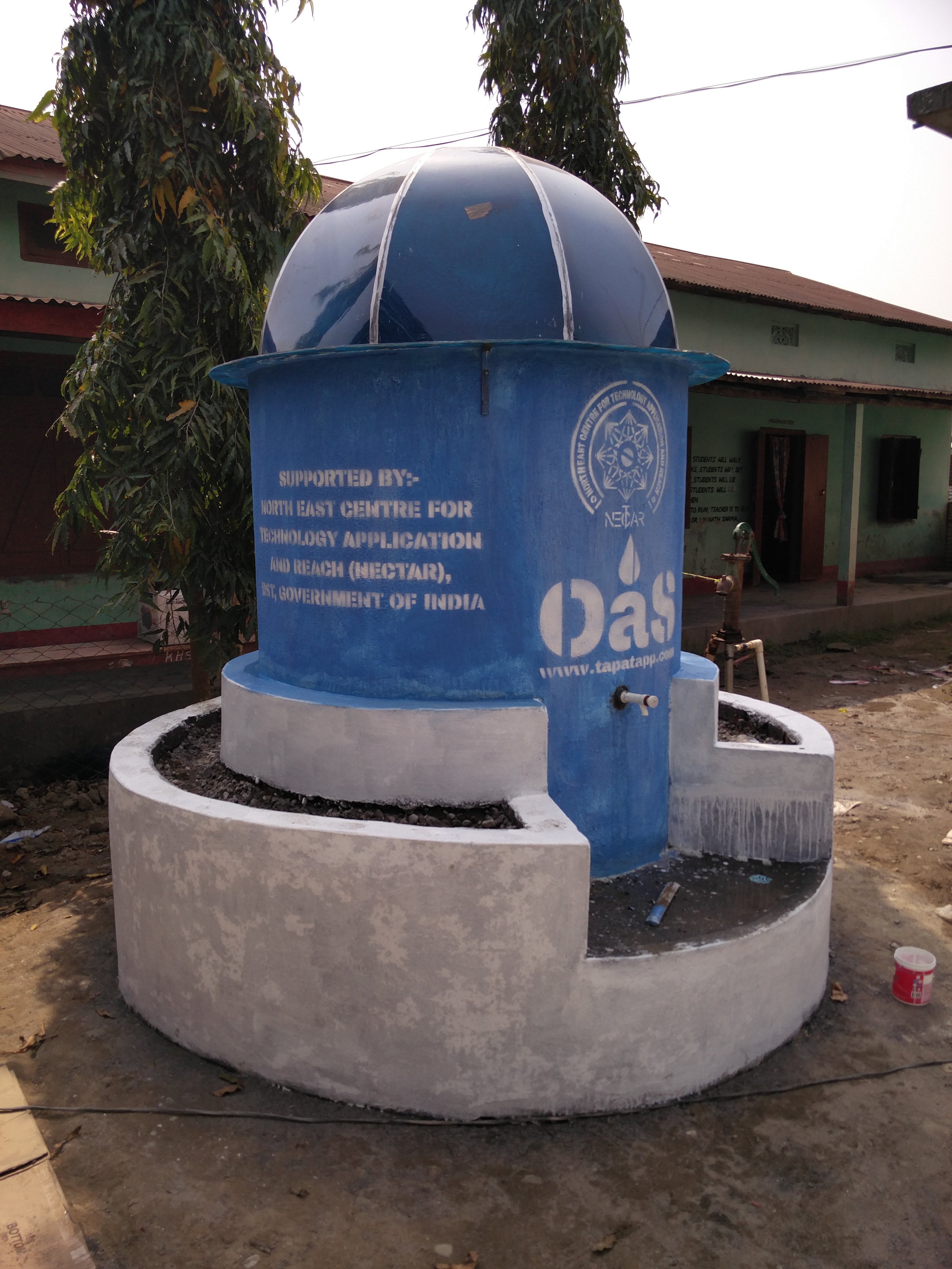
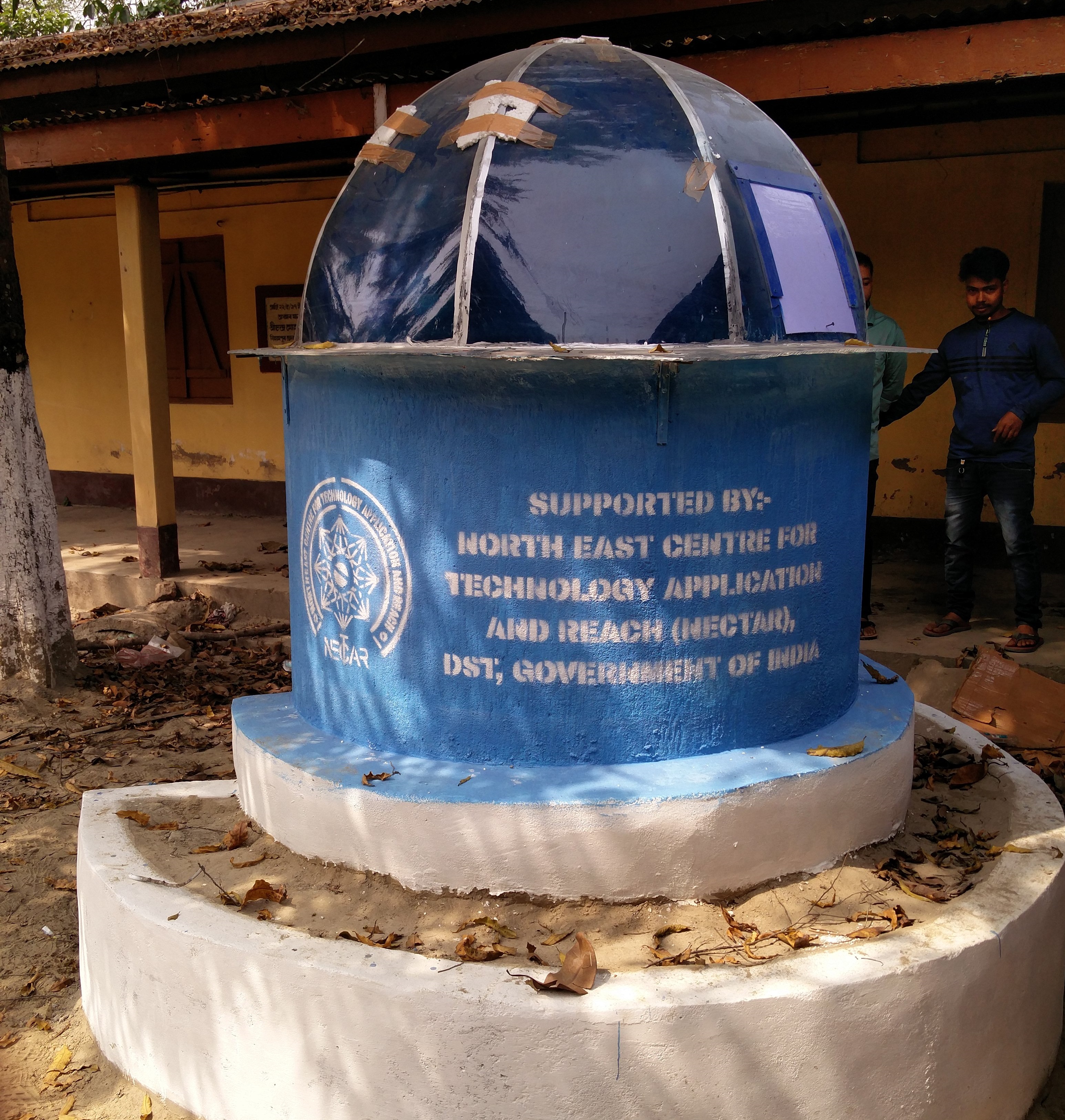
Water is the elixir of life. In the Global South, especially in India, the availability of water determines the social, physical, mental, and economic health of the family. In North-Eastern India, particularly in Assam, groundwater is contaminated with Arsenic and, when consumed, causes Arsenicosis. Arsenicosis causes skin lesions, cancers of the skin, lungs, liver, bladder, and kidney and affects the nervous, respiratory, cardiovascular, and immune systems. Removal of Arsenic from water through filtration is the only viable and safe method to ensure potable drinking water is supplied to the affected population in rural areas. As an implementing agency, NECTAR installed filtration systems in four educational institutes in rural Assam. The filtration system uses indigenously developed technology where arsenic and iron are removed, thus providing low-cost, potable, and contaminant-free drinking water. By ensuring safe and better quality drinking water, the physical and mental health of the future generation is enhanced in these institutes. Water filtration systems installed in the following sites:
- Paramesh Talukdar UMV Baradi, Barpeta district.
- Madhab Choudhury College, Barpeta district.
- Khmardwisa High School, Baksa district.
- Bihampur Girls High School, Nalbari district.
NECTAR has focused on technologies for real time monitoring of rivers with a decision support system for real-time forecasting of floods that integrates data management, monitoring, forecast modelling tools and dissemination methodologies in a single, user-friendly environment.
Based upon rainfall gauge data and satellite grid data, rainfall trends for each catchments and sub catchments are analysed. Rainfall run-offs are performed to estimate total accumulated volume of water in each catchment for optimum water utilization. Several complex Mathematical models and advanced flood modelling tools were used for catchment water availability in Meghalaya. Slope, satellite based rainfall data , roughness coefficient and catchment area etc were used to accurate assessment of runoff through various simulation models to arrive at real time scenarios.
Flood model based on one day forecast was developed on Mahanadi River for Orissa. Backwater effect by raising the height of the Almati dam, on Krishna River was analyzed for Maharashtra Government. Inundation Maps were produced for Tapi River in Gujarat based on UKAI Dam discharge. Watersheds of Meghalaya are being worked upon to estimate the run-off and proposed effective water conservation strategy.
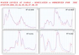
Flood Modelling of Mahanadi River for Water Resource Department of Odisha was taken up in the year 2012-13. The objectives of this project was to develop a pilot decision-support system to improve flood forecasting throughout the basin, estimate areas of expected inundation during floods, assist in the mitigation of flood damage, develop a new forecast technology including support water-use management. During the period Flood-inundation maps at various water levels were generated by running one & two-dimensional steady-flow models through use of advanced software tools viz. Mike-11, Hecras etc. The above task was done by collection of detailed topographic data, survey of India Elevation data, Rain Gauge and discharge data from odisha Government.
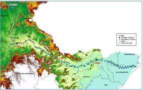
Fig : Flood Modelling for Mahanadi River Catchment and Results of Modelling : Simulated & Observed Water Level.
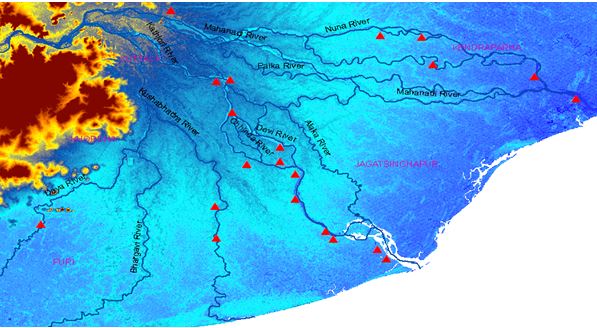
Fig : Rain gauge stations of Mahanadi River Delta areas which have been affected by flood
A case study on generation of Digital Surface Model (DSM) & Land Use data from UAV acquired photographs over Brahmaputra embankments comprising area of about 50 sq km has been accomplished to demonstrate the visualization of flood related disaster and its mitigation. The photographs collected over the area, of 2cm GSD resolution, has provided the condition of the protective embankments and its erosion status along the Brahmaputra River coast.
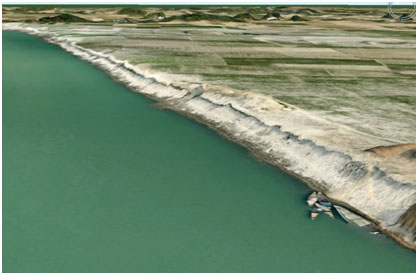
3D GIS analysis of the area has been performed to assist the authorities for mitigation of flood related disaster. It is also realized that periodic imaging through small RPAS.
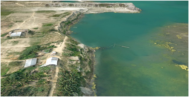
This could also assist the authorities to analyse the pattern of erosion and river sedimentation of Brahmaputra River and suitable preventive measures viz. location & size of protective embankments to be constructed along the river banks to prevent loss of human lives, their households and agricultural crops.
Page Last Updated : 20-07-2024 - 22:12