


Funding Agency:
Meghalaya Biodiversity Board (MBB), Government of Meghalaya
Objective of the Project:
The project aimed to conduct a high-resolution airborne forest survey using LiDAR, hyperspectral, and RGB sensors to analyze carbon sequestration, floral diversity, and phyto-diversity in Meghalaya’s reserve forests. It also aimed to create a forest database, assess forest health, and explore carbon financing opportunities. The project engaged technical experts from institutions like NESAC, JNU, and NEHU for data analysis and validation.
Brief about the Project:
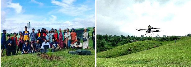
NECTAR conducted a forest survey over 600 sqkm of Meghalaya’s reserve forest areas using a combination of UAVs, helicopter, and airborne sensors. Data was collected from 32 forest patches using LiDAR, hyperspectral, and RGB sensors to assess tree species, canopy density, biomass, and carbon sequestration. The data was processed to create a comprehensive forest database and health assessment, aiding carbon financing and forest management.
Findings and Results:
- Carbon Sequestration & Biomass: AGB and carbon sequestration increased after the monsoon, with Tura Peak and Baghmara showing the highest values.
- Forest Structure: The tallest trees (67m) were found in Tura Peak, with extensive canopy coverage in forests like Baghmara and Gittingiri.
- Species Mapping: Over 400 tree species were mapped, identifying both heterogeneous and homogeneous forests.
- Carbon Sequestration Species: Species like Shorea Robusta and Tectona Grandis were noted for their high carbon sequestration capacity.
- Forest Health: Forests such as Baghmara and Tura Peak were found to be the healthiest, while others showed impacts from issues like human interference and forest fires.
The project successfully mapped the biodiversity and carbon sequestration potential of Meghalaya’s forests, creating a valuable resource for future forest management and conservation efforts.
Funding Agency: North East Social Transformation Foundation (NESTF)
Objectives:
- Conduct high-resolution aerial surveys for agricultural land mapping in Meghalaya.
- Assist in planning afforestation programs with indigenous plant species.
- Support sustainable land management and improve plantation strategies.
- Capacity building for local communities and technical teams on drone operations and data usage.
Brief About the Project:
This project involves NECTAR's aerial drone surveys across four districts in Meghalaya: West Khasi Hills, East Khasi Hills, West Jaintia Hills, and East Jaintia Hills, covering 4500 hectares. High-resolution images were captured to generate maps that support plantation management and afforestation using indigenous species.
Findings and Results:
The drone survey successfully mapped 4500 hectares, providing valuable data for land management. The generated maps have been used to draft afforestation plans for ecosystem restoration. Additionally, the project enhanced local expertise in drone technology and data processing, improving sustainable agricultural practices and land management.
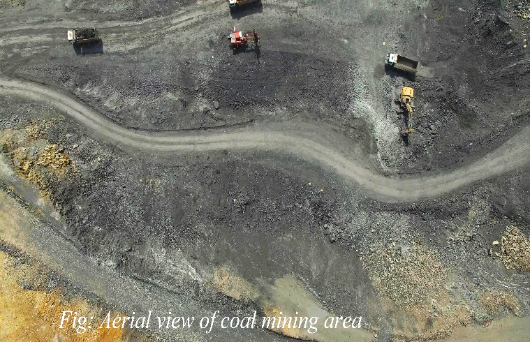
Mahanadi Coalfields Limited (MCL) is one of the major coals producing company of India. MCL produce & market the planned quantity of coal and coal products efficiently and economically in an eco-friendly manner with due regard to Safety, Conservation and Quality. The drone survey in coal mining areas is part of a broader initiative to enhance the accuracy and efficiency of data collection and management in the coal mining sector. The project is conducted by NECTAR, a leading drone service provider in collaboration with Garuda Aerospace’s Limited and Mahanadi Coalfields Limited at Sundargarh & Jharsuguda district of Odisha. NECTAR successfully completed 9000 hector (large scale mapping) mining areas aerial drone survey with RGB sensor.
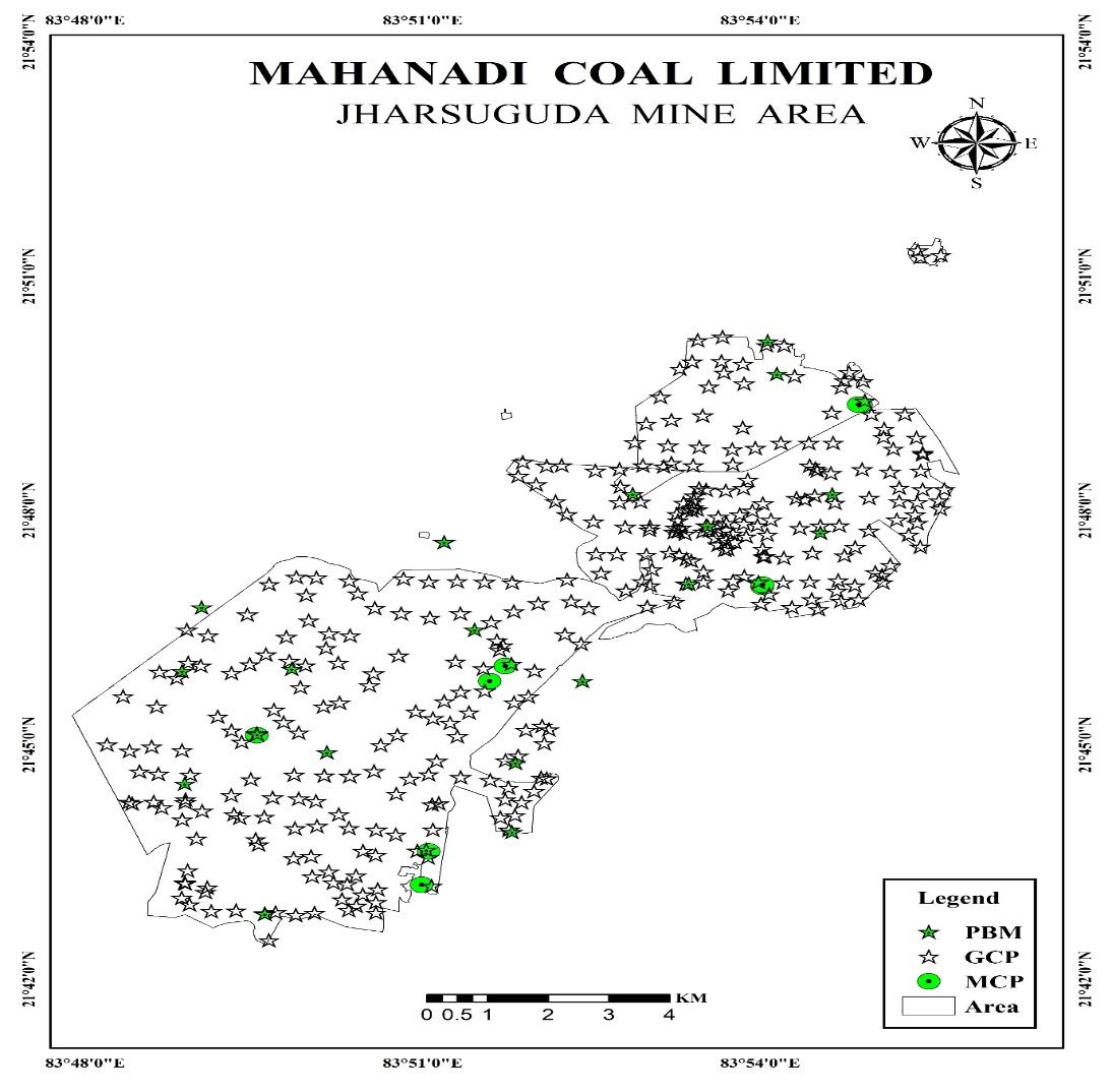
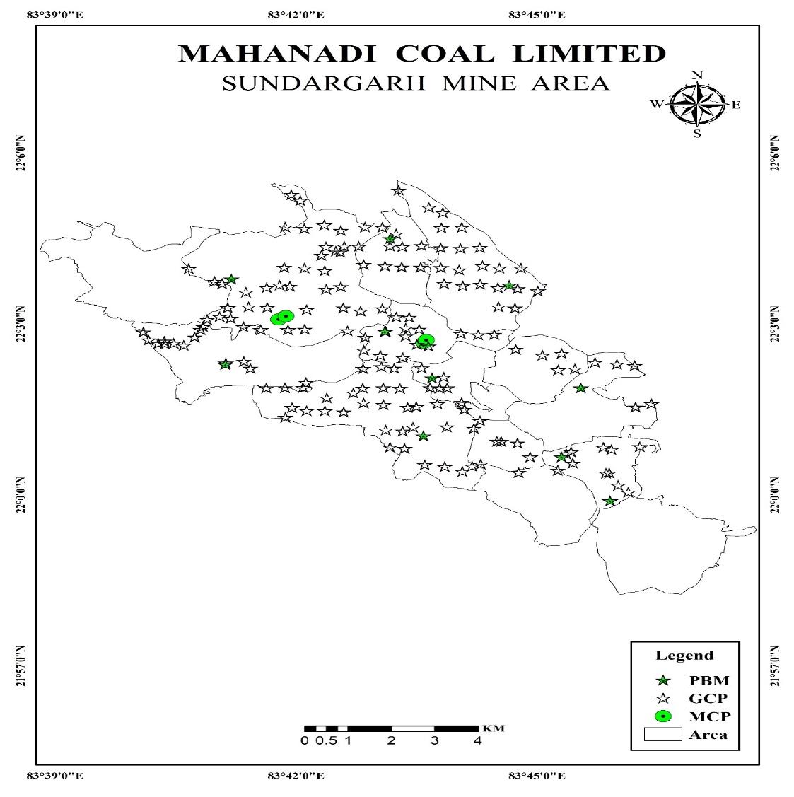
Establishment of Master Control Point (MCP), Permanent Benchmark (PBM), Ground Control Point (GCP) and Drone Data Acquisition.
With the collaboration with Garuda UAV, NECTAR have completed DGPS and Drone Mapping at Mahanadi Coal Limited. The survey works mainly focused on high accurate locational positioning which is helping them for further development and volumetric estimation of the coal mine area. Along with DGPS them have conducted Aerial drone survey of the entire area which will be used various site identification and mining of coal field. The output of the survey work is 519 RTK Ground Control Points, 29 Permanent Benchmarks, 12 Master Control Points.
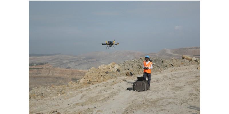
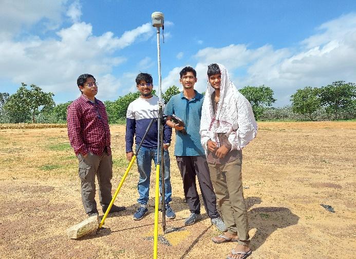
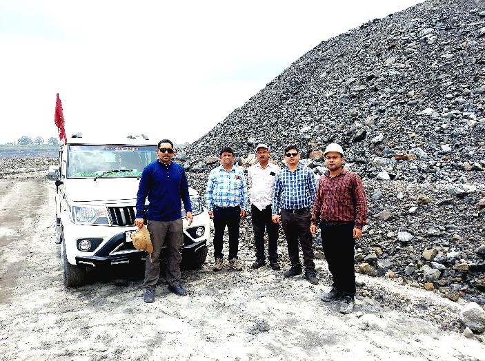
Fig: DGPS survey in coal mining areas.
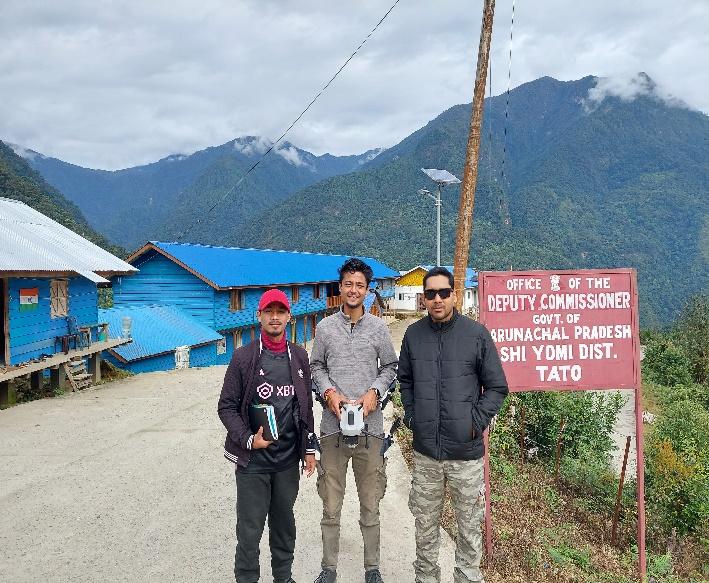
- Arunachal Pradesh: Drone surveys were conducted in 19 villages from the Kipti and Zemithang circles of Tawang district, and 67 villages in Shi-Yomi and Lower Dibang Valley districts. The processed data, including orthomosaic images, Digital Elevation Models (DEM), and point clouds, was submitted to the Survey of India.
2. Rajasthan: A drone survey was carried out in 42 villages in Sirohi district, with the processed data submitted to the Survey of India.
3. Punjab: Surveys were conducted in 112 villages across the Mansa and Moga districts of Punjab, and the data was also submitted to the Survey of India.
4. Chhattisgarh: Over 300 villages in Chhattisgarh were surveyed, with the processed data submitted to the Survey of India.
This shows significant progress in the application of drone technology for land surveys across different states in India, contributing valuable geospatial data to the Survey of India.
Funding Agency- MDoNER
Under PM-DeVINE, NECTAR's Geomatics division led the project "Drone-Based Data Collection for Promoting Organic and Scientific Agriculture in North-East India"; this project involves using drones to collect high-resolution aerial imagery, which will aid scientific organic farming. The tasks include providing high-resolution detailed imagery for crop selection, precise farmland maps and 3D models, and site suitability analyses and crop health assessment. It captures RGB images while making drone flights over targeted areas. Those RGB images are then processed to yield Ortho mosaics, DEMs, DSMs, and other geospatial analytics like point clouds. Multispectral data can be collected upon request. The crop growth stage is monitored from time to time (2-3 times). Deliverables are high-resolution imagery, geospatial data products, analytical reports concerning crop health and environmental factors, and maps for the monitoring of a project. Initial activities relate to sample drone surveys in Meghalaya and Assam, GPS mapping of farm plots, and the deployment of IoT devices for pilot data collection in an Assam lemon cluster. Drone flights for ginger, turmeric, and seasonal vegetables are currently being conducted in the first phase. This project brings to the fore the transformative potential of drone technology and geospatial analysis in augmenting organic farming practices in North-East In
Fig.1- Plot Survey and its attribute data
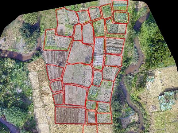
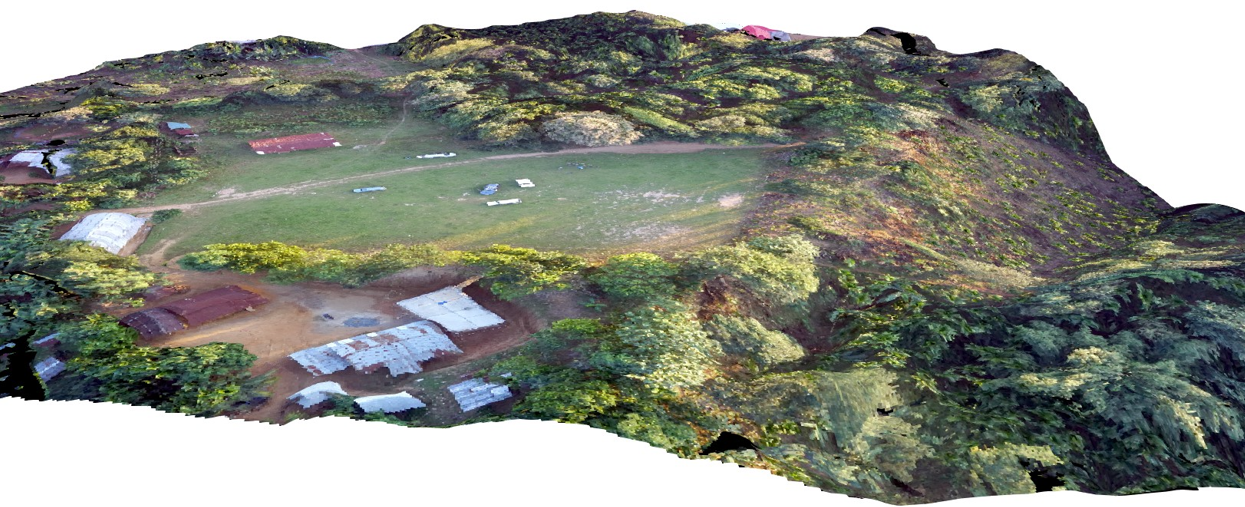
Fig.2- Plot Demarcation on Drone Data Fig.3- 3-D View of one of the cashew Cluster in Garo Hills
- Multispectral & RGB data collection with the help of UAV.
- Total Area – 20 Ha (0.2 Sq.KM)
- Purpose of flying: Khasi Mandarin quality assessment & agriculture mapping.
- Drone: Asteria
- Grid: Single grid and cross grid
- Elevation: 346 M, flying height: 40-50 M, Image Overlapping: 80%-85%
- Average Ground Sampling Distance (GSD): 1 to 4cm
FLY SITE KML:
1.(KML of first location of Khasi Mandarin)
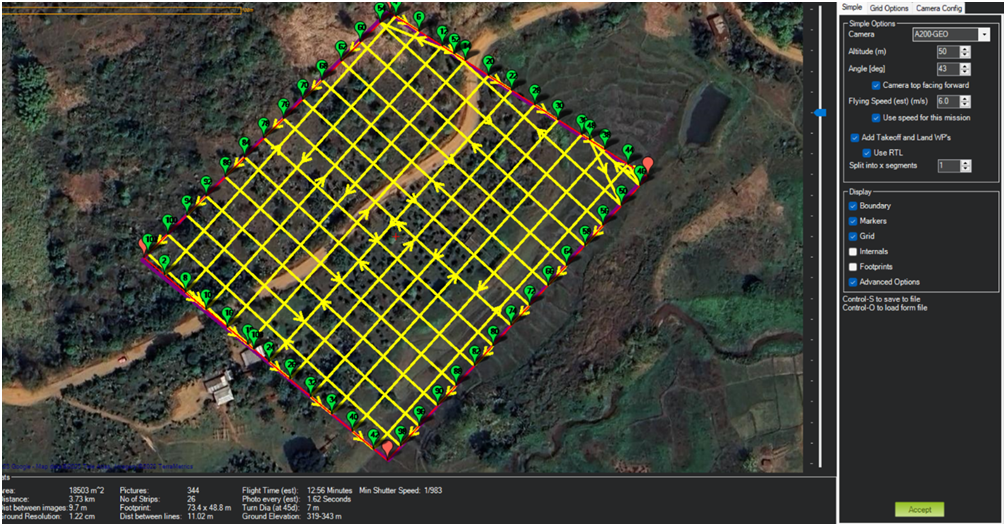
Fig2: Drone Fly Path
DATA PROCESSING:
Software Used: Pix4D
OUTPUT RESULT:
- REPORT
- POINT CLOUD
- DSM
- DTM
- ORTHOMOSAIC
- CONTOUR
- Normalised Difference Vegetation Index (NDVI)
- RGB Processing (Band: Red, Green, Blue)
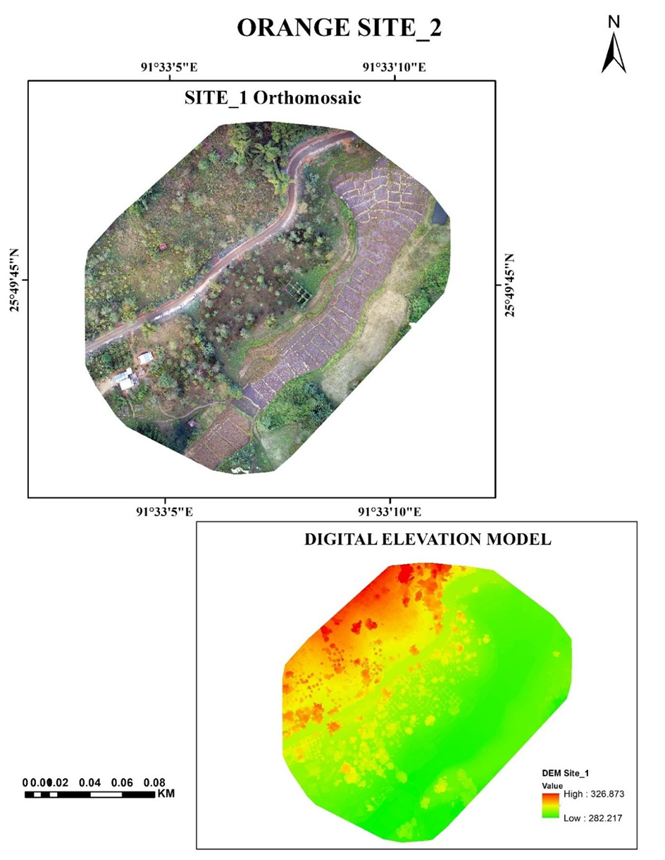
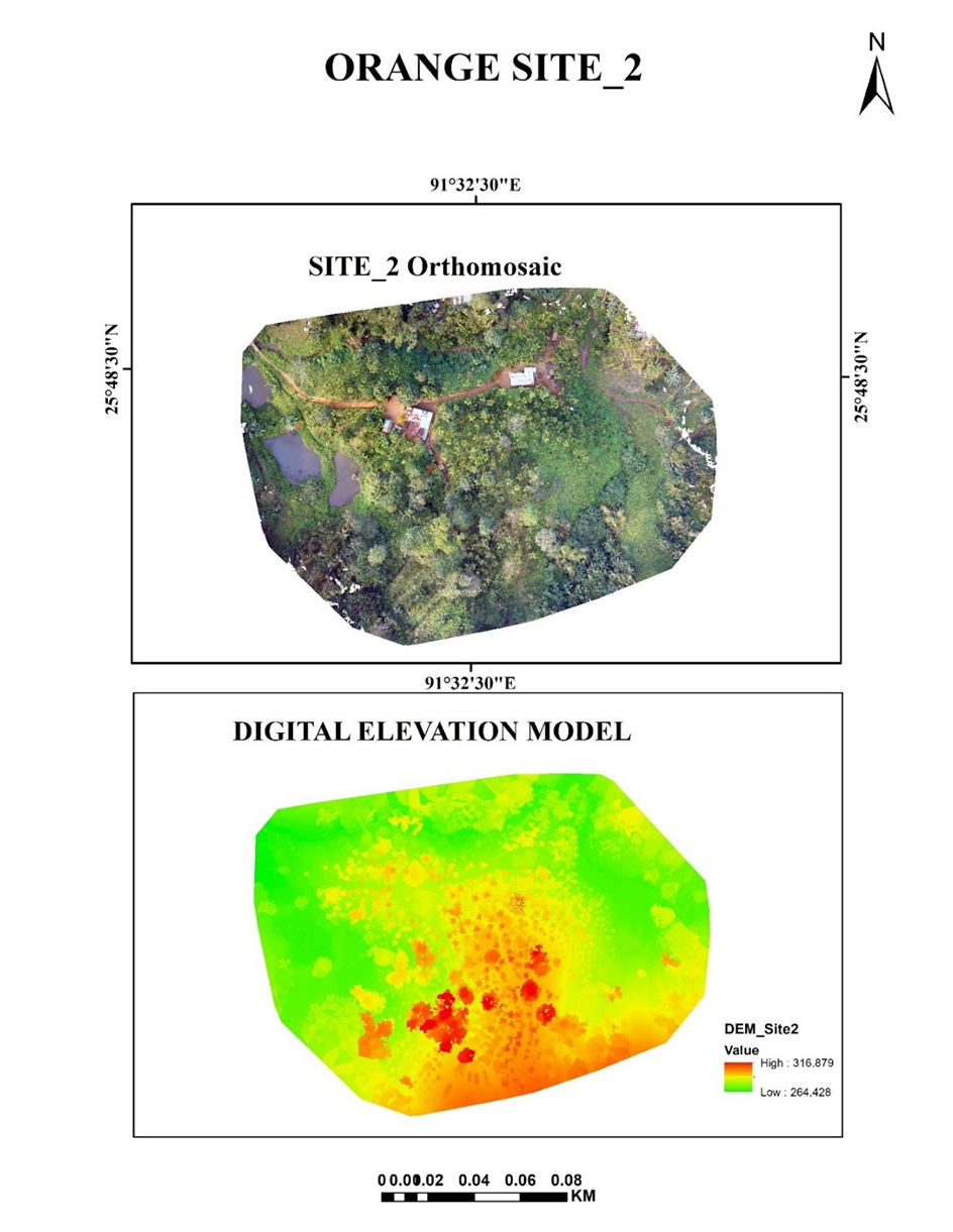
Fig:3 Orthomosaic & DEM Fig:4 Orthomosaic & DEM
MSS PROCESSING:
- Layer Stack
- Band Composition (Band: Red, Green, Blue, NIR, Red Edge)
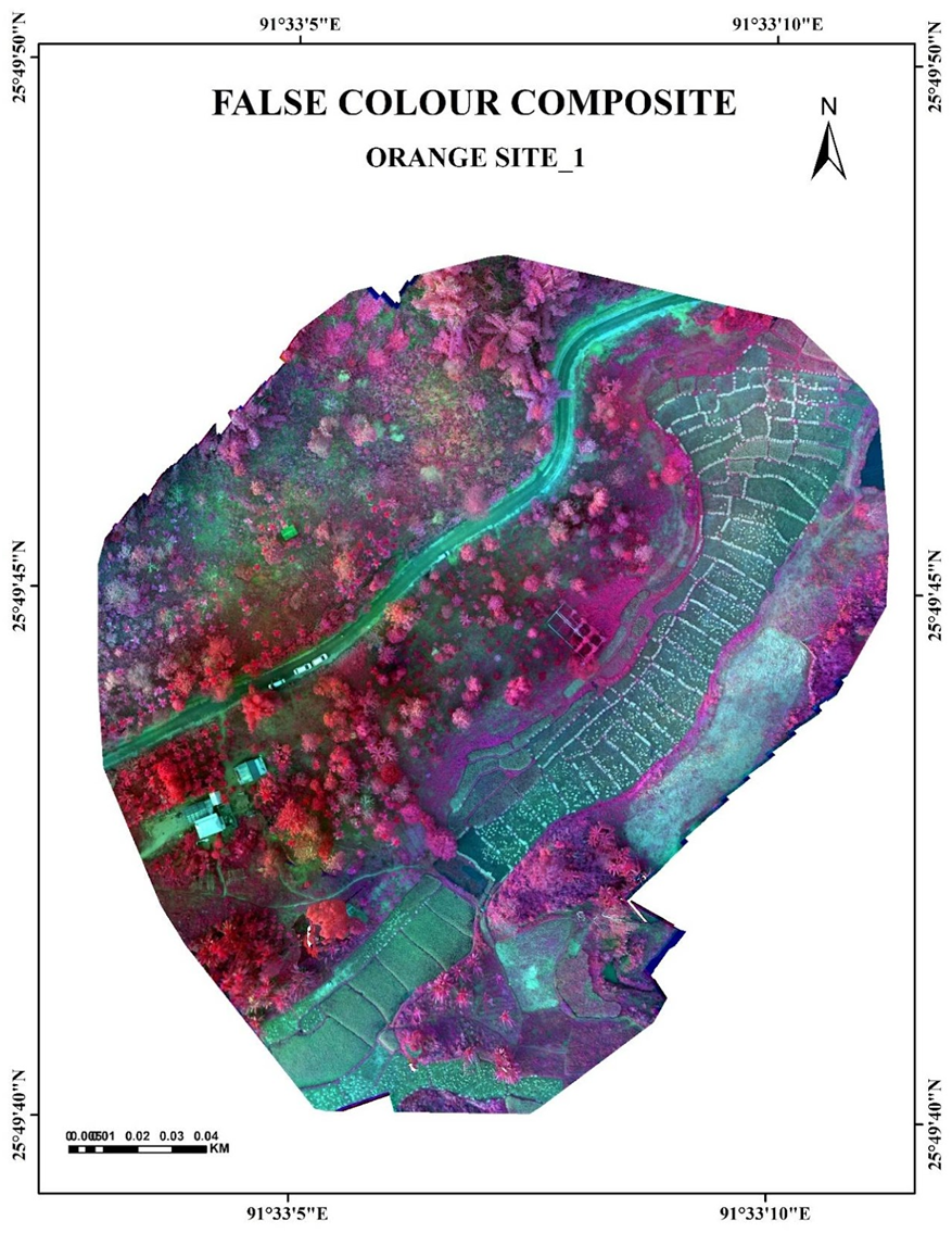
Fig:5 FCC TEAM PHOTO
Last Updated : 10-07-2025 - 11:56


